NWS Gray SKYWARN Amateur Radio Team
The Wireless Society of Southern Maine is proud to support the NWS Gray SKYWARN Amateur Radio Team!
The NWS Gray SKYWARN Amateur Radio
Team is a group of volunteers who support the National Weather Service
Forecast Office, in Gray, ME by using radio to collect and relay timely and accurate reports of
severe
weather to the National Weather Service.
Amateur radio operators have a
long history of supporting the SKYWARN mission at NWS Gray, with the earliest
logs on record dating back to 1986! Their current volunteers are proud to
be a part of that legacy and continue to demonstrate the vital role
that amateur radio plays in supporting the SKYWARN mission. Click here to visit the WX1GYX website.
Join the NWS Gray SKYWARN Slack Channel!
Are
you a trained SKYWARN spotter or interested in severe weather
reporting? Join the SKYWARN Slack channel to connect with other spotters,
participate in real-time discussions, and receive SKYWARN Activation
notifications directly.
Slack Channel: NWS Gray SKYWARN on Slack
(Note: You'll need to join the Slack workspace first if you're not already a member.)
This
channel is open to all spotters and weather enthusiasts in the NWS Gray
coverage area. It's a great place to stay informed and engaged with the
SKYWARN community.
What is SKYWARN?
SKYWARN�
is a volunteer program with nearly 290,000 trained severe weather
spotters across the country. These volunteers keep their local
communities safe by providing timely and accurate reports of severe
weather to the National Weather Service.
To
ensure a network of knowledgeable volunteers and accurate reporting,
those who are interested in becoming spotters are asked to attend a
training session provided by a local office of the National Weather
Service. SKYWARN� training is provided free of
charge and typically
covers these areas:
- Basics
of
thunderstorm development
- Fundamentals
of storm
structure
- Identifying
severe weather features
- Information
to report
- How
to report
- Basic
severe weather
safety
|
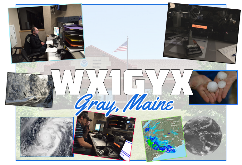
WX1GYX
SKYWARN Amateur Radio Station
The
Radio Desk at
NWS Gray consists of a quad band Yaesu FT8900 (10m/6m/VHF/UHF), Kenwood
TS570 for HF, and a Connect Systems CS801 for DMR.
The station is active during SKYWARN activations as
well
as special events such as SKYWARN
Recognition Day, and the Maine
2 Meter FM Simplex Challenge.
SKYWARN
/ Weather Nets
Kingdom
Weather Net (Vermont) - meets every
Monday-Friday at 8:30PM on
the Jay Peak repeater (K1JAY 146.745 / -
100Hz), and Sunday at 5 PM on 3933 kHz.
New
England Weather Net (New England) - meets every
Monday-Saturday at 5:30-6:30 AM on 3.905 kHz. Click
here for more details.
SKYWARN DMR Net
(New England) - meets every Thursday evening at 7:30 PM on TS1 Talk
Group: 759 (SKYWARN) on the DMR MARC network. Features a
discussion of
weather events and reporting procedures.
SKYWARN Weather Net
(WIRES-X / YSF) - meets every Tuesday evening at 7:00 PM on the UFB New
England Network (WIRES-X Room: 62148 / YSF Reflector: FCS
00339).
Echolink
Weather Net
- 0000 UTC Sunday (Saturday night at 7pm local) on the *WX_TALK* (Node:
7203)
How to Report:
Net
Control Operators should report via the GYX SKYWARN Net Reporting Form
Other methods include:
Phone: (800) 482-0913
Email: gyx.skywarn@noaa.gov
Twitter: @NWSGray
(useful for sending pictures)
Winlink: WX1GYX
Maine
NOAA Weather
Radio Stations
| Site
Name |
Transmitter
Name |
Call
Sign |
Frequency |
Power |
WFO |
| Falmouth |
Blackstrap
Hill |
KDO95 |
162.550 |
500 |
Gray,
ME |
| Ellsworth |
Ellsworth |
KEC93 |
162.400 |
1000 |
Caribou,
ME |
| Milo |
Milo |
KHB54 |
162.550 |
1000 |
Caribou,
ME |
| Frenchville |
Frenchville |
KHB55 |
162.475 |
300 |
Caribou,
ME |
| Meddybemps |
Meddybemps |
KHC47 |
162.425 |
300 |
Caribou,
ME |
| Greenville |
Greenville |
WNG542 |
162.425 |
300 |
Caribou,
ME |
| Jonesboro
(Marine) |
Jonesboro |
WNG543 |
162.450 |
1000 |
Caribou,
ME |
| Sugarloaf
Mtn |
Sugarloaf
Mtn |
WNG547 |
162.450 |
300 |
Gray,
ME |
| Dresden |
Blinn
Hill |
WSM60 |
162.475 |
300 |
Gray,
ME |
| Caribou |
Mars
Hill |
WXM77 |
162.525 |
200 |
Caribou,
ME |
| Springfield |
Lakeville |
WXN28 |
162.500 |
1000 |
Caribou,
ME |
New
Hampshire NOAA Weather
Radio Stations
| Site
Name |
Transmitter
Name |
Call
Sign |
Frequency |
Power |
WFO |
| Deerfield |
Saddleback
Mountain |
KZZ40 |
162.450 |
300 |
Gray,
ME |
| Mt.
Washington |
Mt.
Washington |
KZZ41 |
162.500 |
300 |
Gray,
ME |
| Clarksville |
Ben
Young Hill |
WNG544 |
162.400 |
300 |
Gray,
ME |
| Holderness |
Mt.
Prospect |
WNG545 |
162.550 |
300 |
Gray,
ME |
| Hanover |
Moose
Mountain |
WNG546 |
162.525 |
300 |
Gray,
ME |
| Pack
Monadnock |
Peterborough |
WNG575 |
162.525 |
300 |
Gray,
ME |
| Concord,
NH |
Plausawa
Hill |
WXJ40 |
162.400 |
300 |
Gray,
ME |
Regional
SKYWARN Links
New York
|
Vermont
|
Massachusetts
|
Maine / NH |
Maine
(Eastern) |
Albany,
NY
251 Fuller Road
Suite B-300
Albany, NY 12203
(518) 435-9580
|
Burlington,
VT
1200 Airport Drive
South Burlington, VT 05407
(802) 862-2475
|
Norton/
Boston, MA
46 Commerce Way
Norton, MA 02766
(508) 622-3250
|
Gray
/ Portland, ME
P.O. Box 1208
1 Weather Lane
Gray, ME 04039
(207) 688-3216 |
Caribou,
ME
810 Main Street
Caribou, ME 04736
(207) 492-0170 |
| NWS
Albany |
NWS
Burlington |
NWS
Norton |
NWS
Gray |
NWS
Caribou |
| WX2ALY
SKYWARN |
WX1BTV
SKYWARN |
WX1BOX
SKYWARN |
NWS Gray SKYWARN
|
WX1CAR SKYWARN |
| Hazardous WX Outlook |
Hazardous WX Outlook |
Hazardous WX Outlook |
Hazardous WX Outlook |
Hazardous WX Outlook |
| Current
Observations |
Current Observations |
Current
Observations |
Current
Observations |
Current
Observations |
Current
Observations
Windy.com
National Weather Service Radar (Gray, ME)
|